🌧️ Weather, safety, roads
- SafeTravel – alerts, safety info
- Veður – official weather
- Road.is – road conditions (app + web)
- Umferdin.is – traffic and road info (web)
🅿️ Parking & campsites
- Parka – parking and campsite payments
🧭 Navigation & fuel
- Google Maps
- Waze
- Gasvaktin – cheapest fuel nearby
🚌 Transport & emergencies
- Strætó – public buses
- 112 Iceland – emergency services
🥾 Hiking
- Wapp – Icelandic hiking trails (iOS)
- AllTrails – hiking trails (app + web)
⛺ Camping & mountain huts
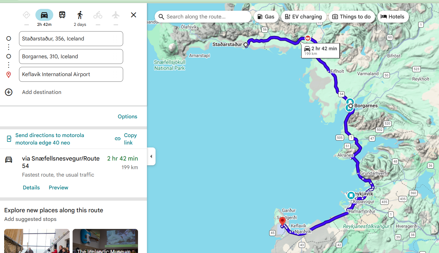
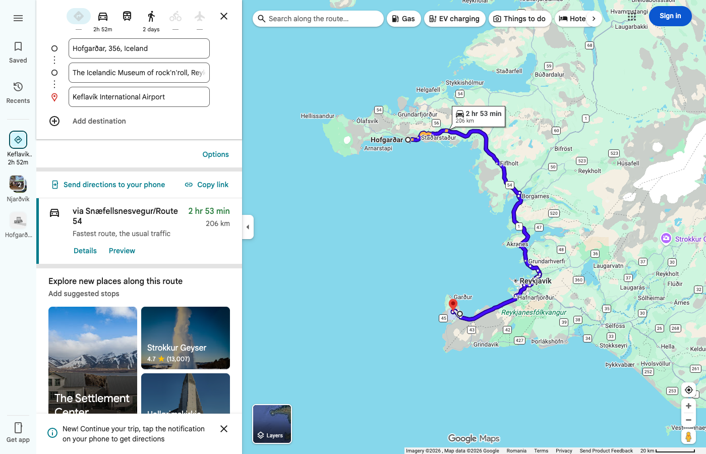
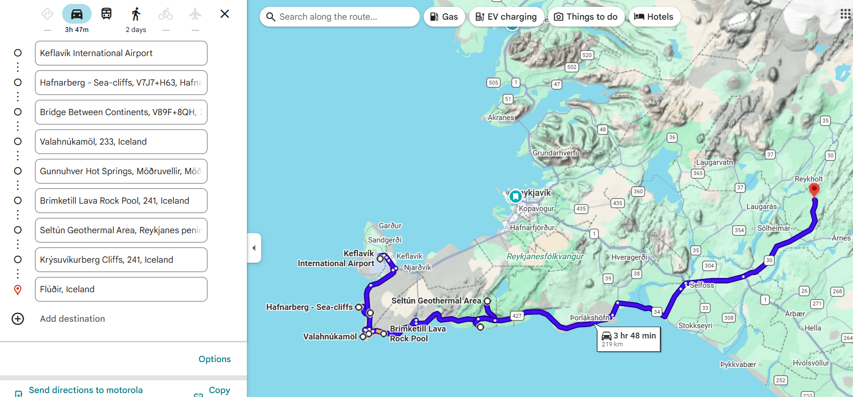
🏠 Accommodation – Flúðir (Night 1 of 2) ✅
🗺️ Possible Stops
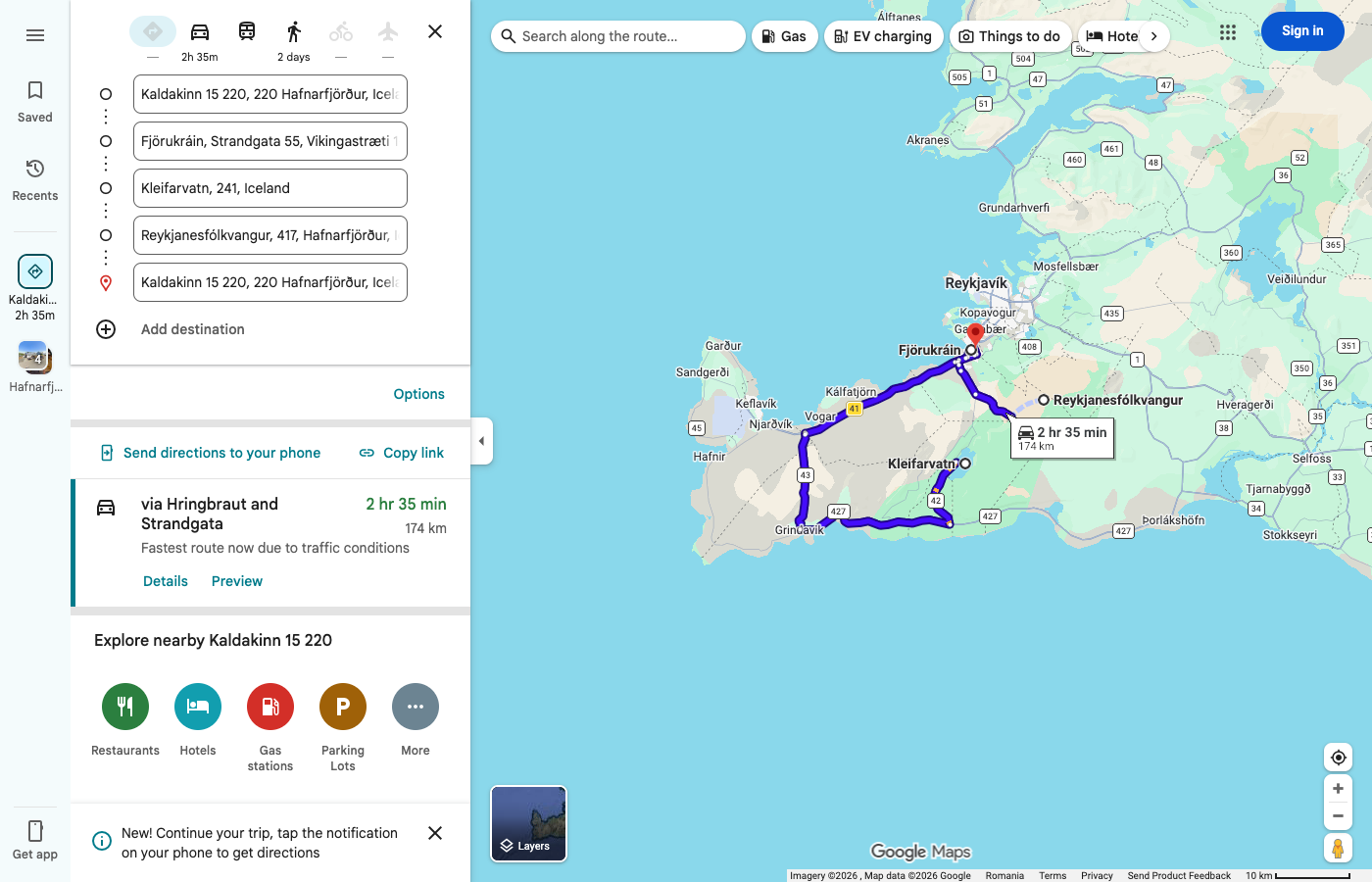
Reykjanes: lakes, fissures, cliffs, geothermal.
No timing, no rush, just chilling all the day.
🏠 Accommodation – Flúðir (Night 2 of 2) ✅
🗺️ Stops
📝 Notes
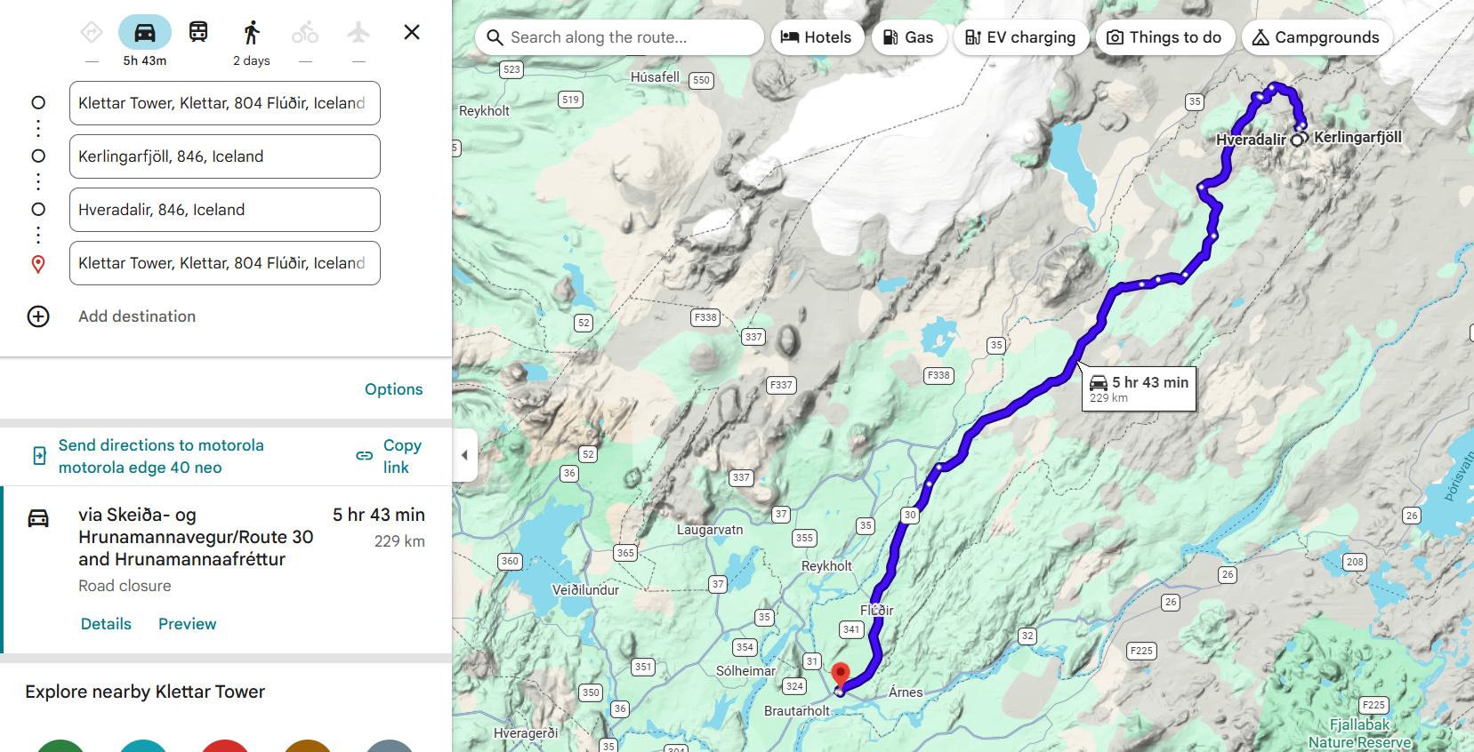
F-road notes: F35 (Kjölur) – long but generally well-maintained highland road, no river crossings. F347 (Kerlingarfjöll access) – short, rocky, but usually in good condition, no river crossings.
Weather-dependent, highland sections may close in poor conditions. Limited cell service in the highlands; facilities only at the resort.
Route: Flúðir → Gullfoss → F35 → Kerlingarfjöll → Hrunamannaafréttur, Leppitunguskáli → Skeiða- og Hrunamannavegur/Route 30 → Flúðir
🏠 Accommodation – Hafnarfjörður (Night 1 of 2) ✅
🗺️ Stops

🏠 Accommodation – Hafnarfjörður (Night 2 of 2) ✅
🗺️ Stops
🏠 Accommodation – Kirkjubæjarklaustur (1 night) ✅
🗺️ Stops
An easy, freestyle day, as we both "know" this part of Iceland.
📝 Notes
Check in at Kirkjubæjarklaustur first, then head to Fjaðrárgljúfur.

🏠 Accommodation – Höfn (1 night) ✅
🗺️ Stops
📝 Notes
No F-roads required. All locations reachable via Ring Road 1 and regular side roads. Múlagljúfur and Yoda Cave access: gravel, 2WD fine in summer.
Puffin spot at Ingólfshöfði cape (~90 km from Kirkjubæjarklaustur) – only accessible at low tide via tractor. Difficult to reach.

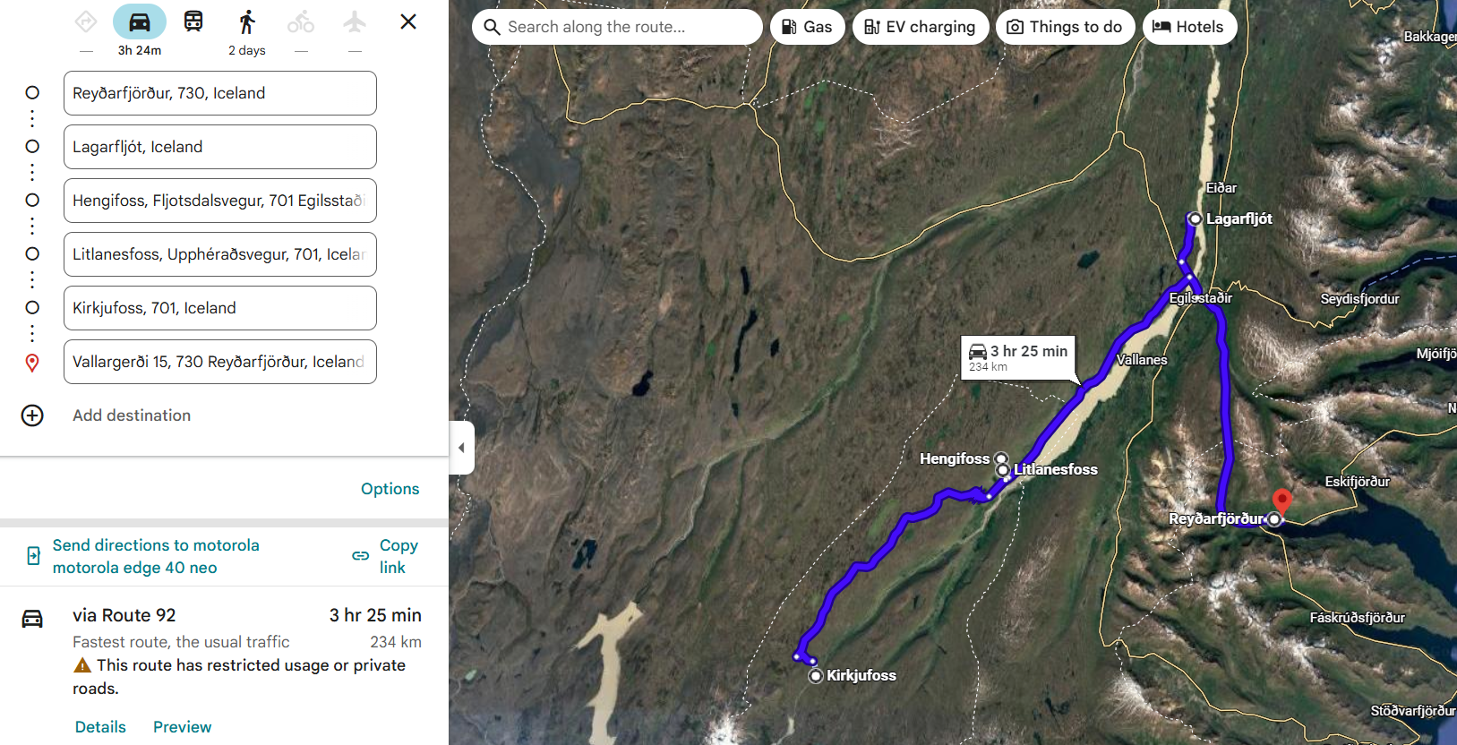
🏠 Accommodation – Reyðarfjörður (Night 1 of 3) ✅
🗺️ Stops
📝 Notes
🤞 Personal wish: find 3 hrs spare time to visit Seyðisfjörður as well – fingers crossed 😊

🏠 Accommodation – Reyðarfjörður (Night 2 of 3) ✅
🗺️ Stops – A strong hiking/walking day 🥾
🏠 Accommodation – Reyðarfjörður (Night 3 of 3) ✅
🗺️ Stops
Main plan: Stuðlagil Canyon. The rest ONLY if conditions are ok – timing, weather, road!
🗺️ Route Map
📏 ~297 km · 🕐 ~4 h 51 min driving (full conditional loop, gravel/highland)
📍 Open in Google Maps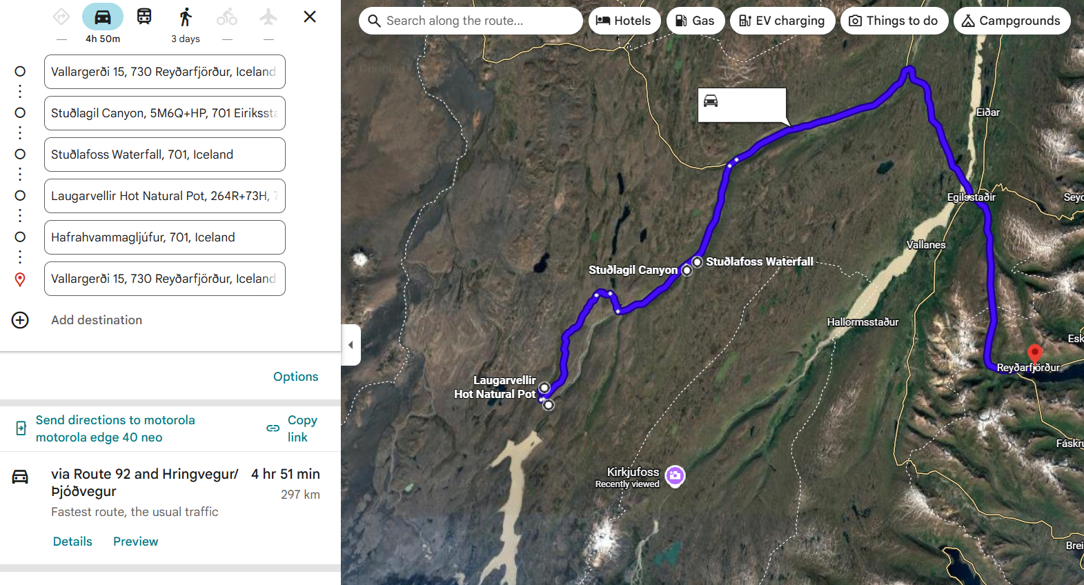
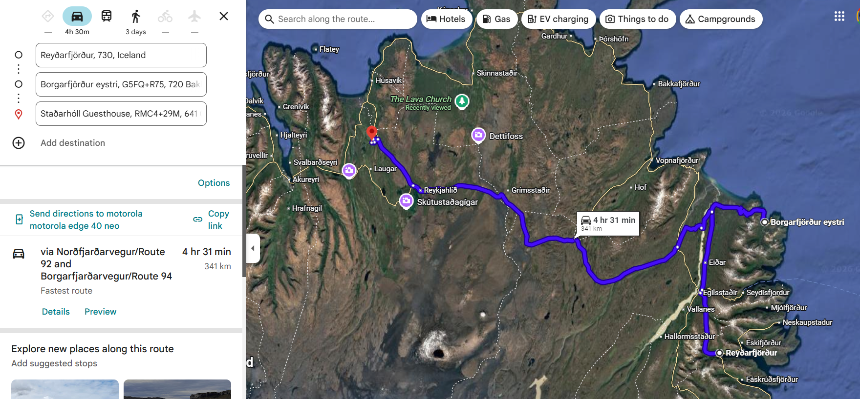
🏠 Accommodation – Grenjaðarstaður (Night 1 of 2) ✅
🗺️ Stops
Route: Bakkagerði → Route 1 → Route 862 (Dettifossvegur west) → Selfoss → Kirkjan → Ásbyrgi → Húsavík
📝 Notes
Approx. driving distance for the full route: ~350 km · Estimated driving time: 4–5 hrs. Much more with the stops 😊
🏠 Accommodation – Grenjaðarstaður (Night 2 of 2) ✅
🗺️ Stops
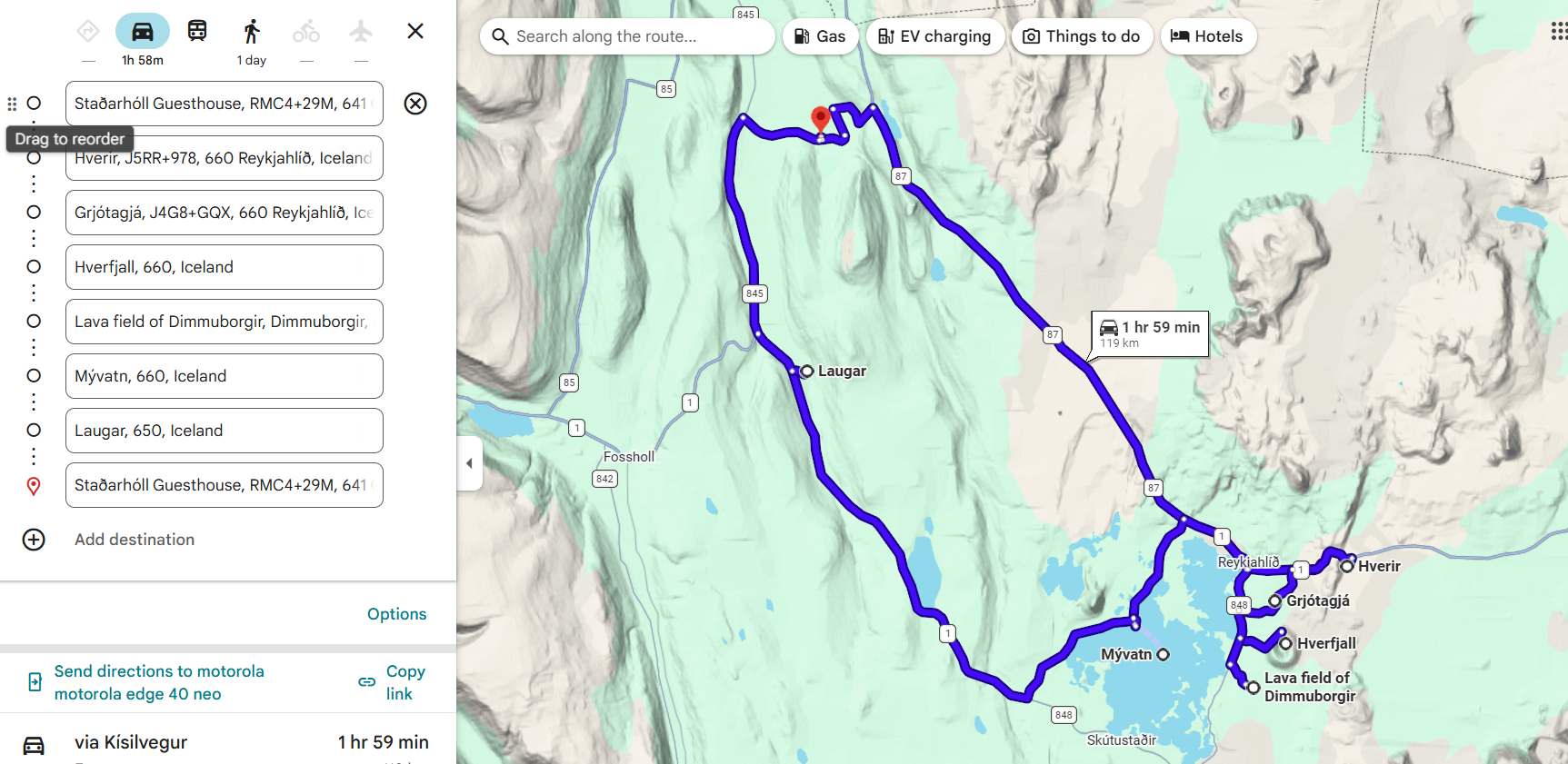
🏠 Accommodation – Staðarflöt (1 night) ✅
🗺️ Stops
This day will be "boring", just driving 😊
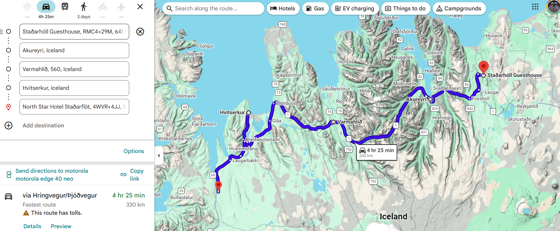
🏠 Accommodation – Snæfellsnes (1 night) ✅
🗺️ Stops
Staðarflöt → Eiríksstaðir → Stykkishólmur → Helgafell → Kirkjufell → (Ólafsvík) → Hellnar → Arnarstapi → Búðir → Staðarstaður